Location
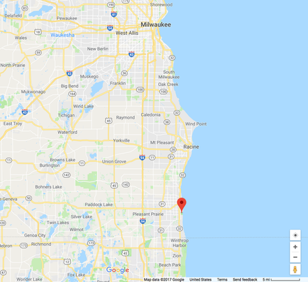
Map View
|
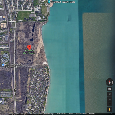
Satellite View
|
- Kenosha Sand Dunes is located along the Lake Michigan coastline about 5 miles north of the Wisconsin-Illinois border.
- The Kenosha Sand Dunes area is part of the Chiwaukee Prairie State Natural Area; it is designated as a state natural area.
1976-1978 Inventory
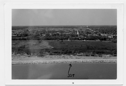
South End
|
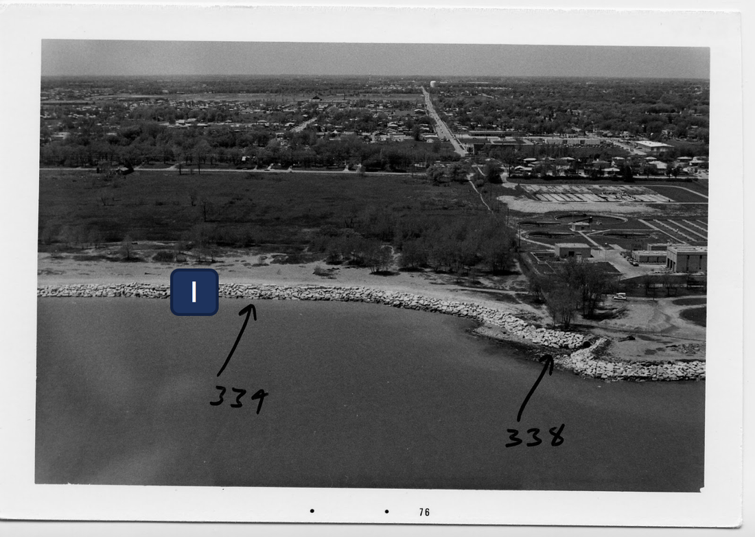
North End
|
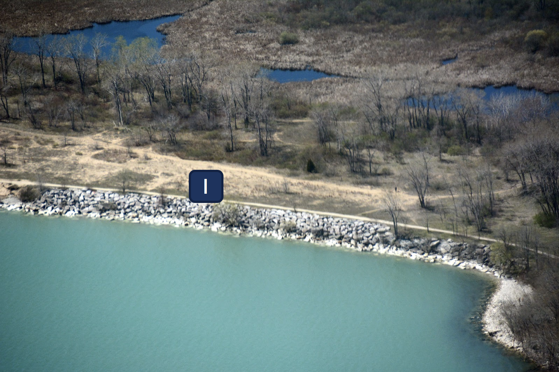
Prior to the first shoreline inventory, the coastline at Kenosha Sand Dunes was already armored with a rock revetment. This revetment can be seen along the entire coastline; for reference, the number 1 marker covers the revetment. Revetments protect the bottom of slopes from being eroded by water. It appears that the revetment was successfully protecting the dunes from erosion even though the water level was above average and right up to the bottom of the stone structure.
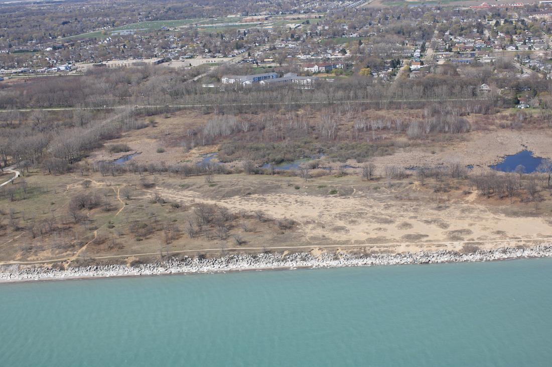
At this location, there is a large-scale feature to take notice of: there is a large cove shape that is indicative of an erosional coastline. The recessional shape of the coastline can be seen in the picture of the north end of the area. Between the locations pointed out with arrows labeled 338 and 339, there is an obvious recession of the coastline that likely resulted from erosion. Additionally, in the satellite view of the Kenosha Sand Dunes, the cove structure can be seen. We predict that the revetment was put in place to prevent or limit further erosion of the dunes that caused the cove shape.
At this location, there is a large-scale feature to take notice of: there is a large cove shape that is indicative of an erosional coastline. The recessional shape of the coastline can be seen in the picture of the north end of the area. Between the locations pointed out with arrows labeled 338 and 339, there is an obvious recession of the coastline that likely resulted from erosion. Additionally, in the satellite view of the Kenosha Sand Dunes, the cove structure can be seen. We predict that the revetment was put in place to prevent or limit further erosion of the dunes that caused the cove shape.
2012 Inventory
South End
|
North End
|
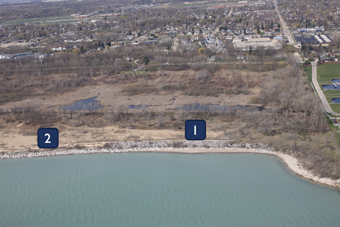
By 2012, the condition of the revetment had changed at Kenosha Sand Dunes. Location 1 in the image shows that the north end of the revetment has remained stable with the rocks at the same height and angle; however, the revetment near location 2 has been damaged. Many of the rocks have been pulled away from the slope and into the water. We hypothesize that the high water levels of the mid-80s and late-90s took a toll on the revetment. Despite the damage to the revetment, it is still protecting the coastline from erosion. Due to the differences in the condition of the revetment that can be seen at locations 1 and 2, we predict that the northern end is more protected from wave action while further south, by location 2, is more affected by wave action.
2017 Inventory
South End
|
North End
|
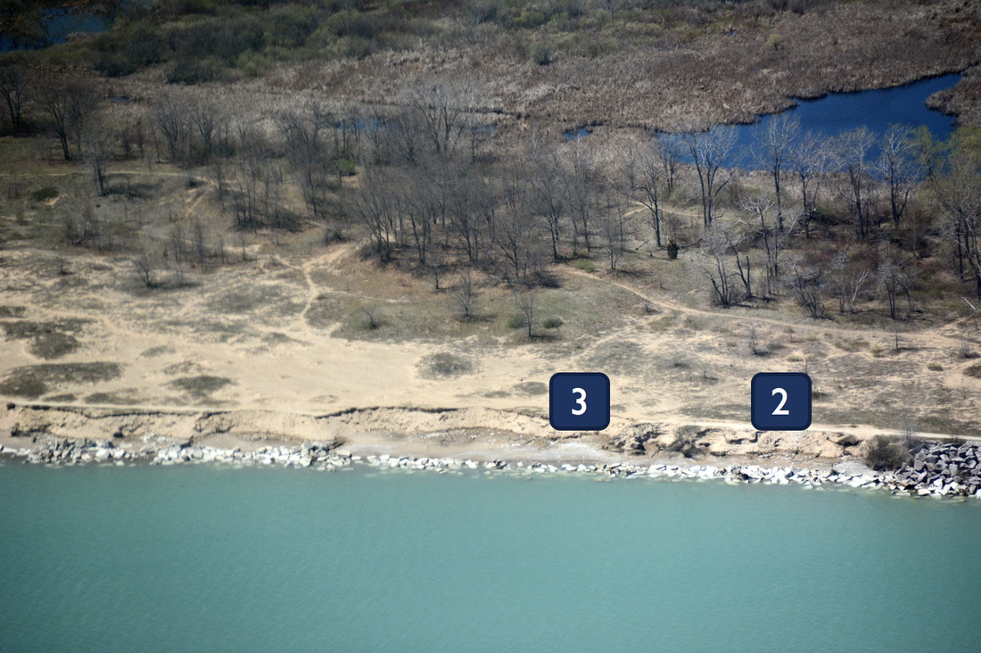
The 2017 inventory shows a stark change in the condition of the revetment and the coastline from 2012. The north side remains in good condition, which can be seen by location 1. However, as can be seen by location 2, the rock revetment has completely failed and resulted in severe erosion of the coastline. The erosion has resulted in small coves; these coves can be seen by location 3.
What caused this significant change? We predict that excessive wave action caused the failure of the revetment. As seen on our page, "Lake Michigan Water Levels," water levels between 1999 and 2014 were actually below average and since then have not been much higher than average. Our prediction comes from noticing that the extremely high water levels of the mid-80s had very little effect on the condition of the revetment and realizing that something big had to have happened here. In fact, it did. On October 31, 2014, a storm brought very large waves to the shores of Lake Michigan. Many local residents took notice that this storm was the start of the horrible erosion at this location. It is interesting to consider how one event can completely change conditions that have held up over many decades.
What caused this significant change? We predict that excessive wave action caused the failure of the revetment. As seen on our page, "Lake Michigan Water Levels," water levels between 1999 and 2014 were actually below average and since then have not been much higher than average. Our prediction comes from noticing that the extremely high water levels of the mid-80s had very little effect on the condition of the revetment and realizing that something big had to have happened here. In fact, it did. On October 31, 2014, a storm brought very large waves to the shores of Lake Michigan. Many local residents took notice that this storm was the start of the horrible erosion at this location. It is interesting to consider how one event can completely change conditions that have held up over many decades.
November 4, 2017: Field Trip for Coastal Engineering
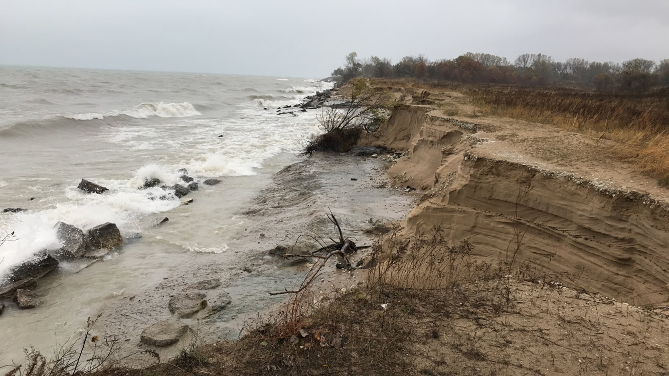
Looking South
We, along with our classmates, were able to visit the Kenosha Sand Dunes in early November of 2017. We saw first hand the results of the significant erosion that has left behind very steep angles on the coastline as well as coves receding further inland.
Local residents now face a challenge in considering whether they would like another coastal structure to be built in this natural area to protect from further erosion or if it should be left alone to let nature take its course.
Local residents now face a challenge in considering whether they would like another coastal structure to be built in this natural area to protect from further erosion or if it should be left alone to let nature take its course.
